
Salish Sea GeoTour : geology on, under and around the Salish Sea of British Columbia / written by Kiri Westnedge and designed by Avril Goodall. : M4-95/2-2010E
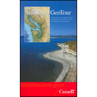
Explore the geology and landscape of the Salish Sea with your own geologist-in-your pocket guidebook and map. Travel by water and land, over massive underwater sand dunes, ancient fault lines and disappearing islands. Each section of the guide includes directions to stops of interest along the highways and ferry routes of the Salish Sea, an explanation of what you’re looking at, and a description of the geological history of the area.
Lien permanent pour cette publication :
publications.gc.ca/pub?id=9.652079&sl=1
| Ministère/Organisme |
|
|---|---|
| Titre | Salish Sea GeoTour : geology on, under and around the Salish Sea of British Columbia / written by Kiri Westnedge and designed by Avril Goodall. |
| Type de publication | Monographie |
| Langue | [Anglais] |
| Autres langues publiées | [Français] |
| Format | Texte matériel |
| Note(s) |
|
| Information sur la publication |
|
| Reliure | Softcover |
| Description | [124]p. : coloured maps, photographs ; 24 cm. + "Salish Sea Touring Map". |
| ISBN | 978-0-660-20006-4 |
| Numéro de catalogue |
|
| Descripteurs |
Demander des formats alternatifs
Pour demander une publication dans un format alternatif, remplissez le formulaire électronique des publications du gouvernement du Canada. Utilisez le champ du formulaire «question ou commentaire» pour spécifier la publication demandée.Détails de la page
- Date de modification :