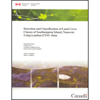
Detection and classification of land cover classes of Southampton Island, Nunavut, using Landsat ETM+ data / [by] Alain J. Fontaine, Mark L. Mallory. : CW69-1/119E

The purpose of this project was to generate a detailed baseline habitat map of the distribution and abundance of the various land cover types that comprise Southampton Island.
Lien permanent pour cette publication :
publications.gc.ca/pub?id=9.620210&sl=1
| Ministère/Organisme | Canadian Wildlife Service. |
|---|---|
| Titre | Detection and classification of land cover classes of Southampton Island, Nunavut, using Landsat ETM+ data / [by] Alain J. Fontaine, Mark L. Mallory. |
| Titre de la série | Occasional paper - Canadian Wildlife Service0576-6370No. 119 |
| Type de publication | Série - Voir l'enregistrement principal |
| Langue | [Anglais] |
| Autres langues publiées | [Français] |
| Format | Papier |
| Note(s) | Incorrect catalogue number (En84-86/2011E) printed in this publication. |
| Information sur la publication | Yellowknife - Northwest Territories : Environment Canada. July 2011. |
| Reliure | Softcover |
| Description | 104p. : maps, tables, photographs ; 28 cm. |
| ISBN | 978-1-100-19086-0 |
| ISSN | 0576-6370 |
| Numéro de catalogue |
|
Demander des formats alternatifs
Pour demander une publication dans un format alternatif, remplissez le formulaire électronique des publications du gouvernement du Canada. Utilisez le champ du formulaire «question ou commentaire» pour spécifier la publication demandée.- Date de modification :